Northeast Regional Marine Fish Habitat Assessment
Overview
The Northeast Regional Marine Fish Habitat Assessment (NRHA) is a collaborative, multi-disciplinary effort to describe and characterize estuarine, coastal, and offshore fish habitat distribution, abundance, and quality in the Northeast. The project aims to align habitat science goals and priorities with human and financial resources to develop habitat science products that support an assessment. The NRHA Steering Committee is composed of leadership from the major habitat conservation, restoration, and science organizations in the region.
This project is oriented around four core actions:
Abundance and trends in habitat types in the inshore area. This action will map the location and extent of habitat types utilized by the focus species and quantify the areal coverage, status and trends of these habitats. It will also compile metrics that may inform an assessment of habitat quality.
Habitat vulnerability. This action will involve Council and Commission staff coordination with, and participation in, the NOAA Habitat Climate Vulnerability Assessment (HCVA). That assessment will use habitat experts to examine fish habitat vulnerability to climate and non-climate stressors.
Spatial descriptions of species habitat use in the offshore area. This action will use model-based and empirical approaches to identify, predict, and map habitat use for each of the focus species and track and quantify changes in habitat use over time (e.g. seasonal, annual, and future predicted use).
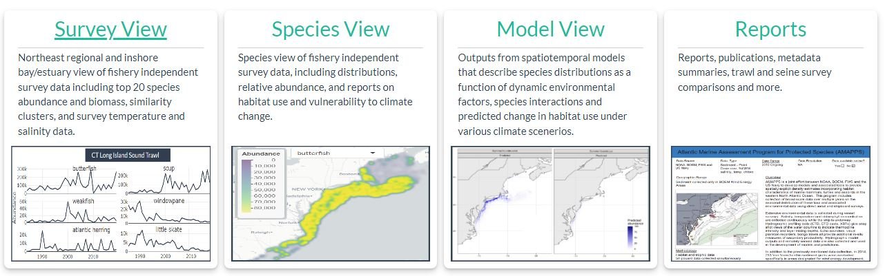
Habitat data visualization and decision support tool. Habitat information will be incorporated into a publicly accessible decision support tool, making this information available to partners to visualize habitat location, extent, and use throughout the region, and provide access to relevant data and habitat metrics developed by the assessment.
Assessment Products
All NRHA products are housed in the NRHA Data Explorer Tool, an R-Shiny application used to explore data on trends in fish species distribution at state and regional scales, and to share other products and documentation including model-based outputs and reports. New data and reports are being added to the Data Explorer as they become available - check back for updates!
Steering Committee Member Organizations
Mid-Atlantic Fishery Management Council (Chair)
Atlantic States Marine Fisheries Commission
Atlantic Coast Fish Habitat Partnership
Duke University
Monmouth University
National Fish Habitat Partnership
New England Fishery Management Council
NOAA Fisheries Offices of Habitat Conservation (Headquarters and Region)
NOAA Fisheries Offices of Science and Technology (Ecosystems and Monitoring)
NOAA Northeast Fisheries Science Center
NOAA NCCOS Marine Spatial Ecology Division
The Nature Conservancy
Contacts
For more information, please contact the action leads:
Jessica Coakley, MAFMC (jcoakley@mafmc.org)
Michelle Bachman, NEFMC (mbachman@nefmc.org)
Christopher Haak, Monmouth University/NOAA (chrishaak@monmouth.edu)
Tori Kentner, MAFMC (tkentner@mafmc.org)
Laurel Smith, NMFS NEFSC (laurel.smith@noaa.gov)